
EMLID
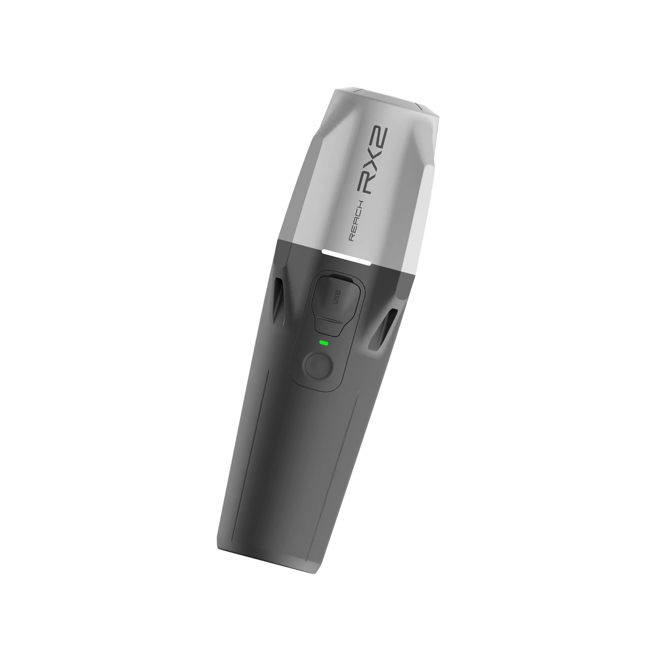
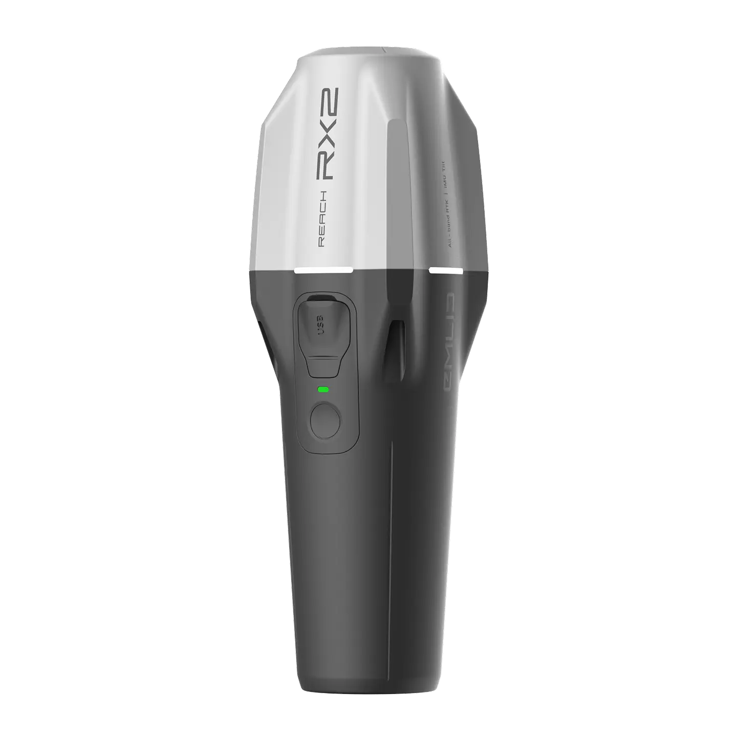
Reach RX2
Compact RTK rover with IMU tilt
compensation and centimeter
precision
From R33 299 Excl VAT
20 + App Configuration
Emlid Flow
Work with CAD files and DTMs, collect and stakeout points and lines
Pix4D Catch
3D scanning workflows with an iPhone augmented with RTK accuracy
Esri Collector
Unlocking precision at scale for companies already using ESRI ecosystem
Pocket-sized and lightweight
Compatible with ArcGIS Field Maps and other GIS apps
Minimal training required
Key features
Centimeter accuracy
GPS, GLONASS, Galileo, BeiDou, QZSS, and NavIC for stable performance even under canopy or in urban areas.
Just add NTRIP
Gets corrections from any CORS or NTRIP service in RTCM3. No settings to get wrong
Compact & rugged
Only 280 g, fits in your pocket or glove compartment. IP68-rated for rain, snow, and dust.
IMU tilt compensation
Measure accurately without leveling the pole, even near walls, slopes, or in tight spaces.
16 hours on one charge
Two work days of operation, charges
via USB-C in under 3 hours.
Scales with your team
Easy to learn and use, with no training days or long manuals needed.
High accuracy, even under canopy
Centimeter-level accuracy
Simply connect the RX2 to a CORS network to receive corrections and get a precise location in RTK.
All-band rover
It tracks all carrier frequencies of GPS, GLONASS, Galileo, Beidou, QZSS and NavIC. This ensures fast, stable performance under canopies and near buildings.
From R33 299 Excl VAT
Terrestrial scanning with centimeter precision
RX2 supports terrestrial scanning with high accuracy, just mount it on a handle and pair it with a scanning app like PIX4Dcatch.
Capture precise 3D models of vertical surfaces and hard-to-reach areas for utility mapping, volume calculations, and as-built documentation.

Emlid Flow: keep the field and the office in sync
Emlid Flow is a mobile app designed for fieldwork, offering instant sync with the cloud-based Emlid Flow 360 platform
- Mark out designs
- Measure slopes and cut & fill
- Locate existing site features
- Stake out boundaries
- Monitor and adjust projects on the go
Ensure that the whole team is working with the latest data, and monitor progress in real time
Compatible with ArcGIS and other GIS apps
Missed elevations, wrong coordinates, or delayed deliverables? These aren’t just setbacks, they’re liabilities.
You need accurate, georeferenced data you can trust, collected efficiently and processed fast.
High precision for terrestrial scanning
Works with PIX4Dcatch and other scanning apps to capture precise 3D models of buildings, surfaces, and hard-to-reach areas, perfect for utility mapping, volume calculations, and as-built documentation.
From R33 299 Excl VAT
HAVE ANY QUESTIONS?
Request A Quote
Want to book a demonstration, you can do so by following the link below.
Book a demonstration
Want to book a demonstration, you can do so by following the link below.