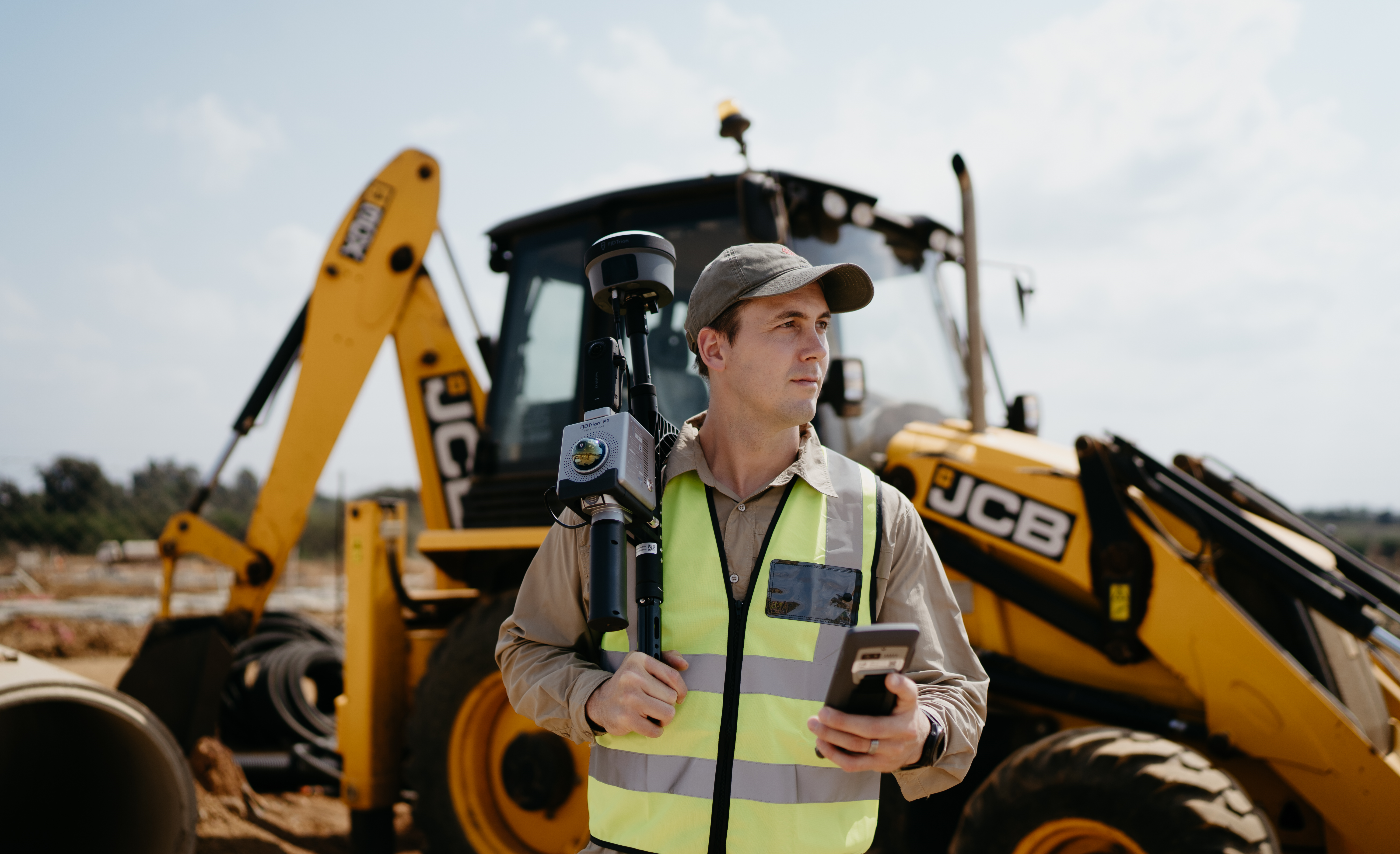
Engineering Surveying, Done Right
Capture, mark, and model with centimeter precision on any site, in any condition.
Measure
Model
Execute
When Site Data Fails, Projects Fail.
Missed elevations, wrong coordinates, or delayed deliverables? These aren’t just setbacks, they’re liabilities.
You need accurate, georeferenced data you can trust, collected efficiently and processed fast.
The Problem
Engineering projects start with the ground but most still rely on outdated surveying methods that are slow, labor-intensive, and error-prone.
Whether you're planning a road, dam, tunnel, or building, you can’t afford guesswork.
? Manual measurements miss detail
? Traditional setups take too long
? Complex terrain makes layout nearly impossible
? Clients demand deliverables faster, and with more precision
Design with Data You Can Trust From the First Site Visit to Final Deliverable
Leverage LiDAR + RTK GNSS + BIM/CAD workflows to capture real-world site conditions with centimeter precision.
Reduce rework. Improve accuracy. Deliver confidently.
Survey Smarter with FJD Trion Solutions
High-accuracy tools that move as fast as your project.
SOM brings you a fully integrated field-to-office system that combines:
- LiDAR scanning solutions (FJD Trion S2 & P1 LiDAR Scanners)
- RTK/IMU receivers - (FJD V1t RTK Rover & FJD V10i Receiver)
- Powerful software workflows, from capture to CAD - Using BricsCAD or Your Preferred CAD Software
Built for engineers. Trusted across Africa.
Here’s How You Go from Field to Final Deliverables
1. Capture Real-World Conditions
- Scan bridges, tunnels, roads, or buildings using Trion S2 (handheld) or Trion P1 (vehicle/drone-mounted)
- Get dense, colorized point clouds with up to 1.2 cm accuracy
- Works in GNSS-denied environments with SLAM + VIO fusion
2. Mark Critical Points
- Use the Trion V1t for RTK surveys with satellite precision
- Use Trion V10i for tilt-compensated layout on slopes or tight areas
- Accurately locate and mark utility lines, structure edges, foundations, and more

3. Deliver With Confidence
- Process with Trion Model Software: clean, register, and model
- Export IFC, DWG, E57, or LAS for CAD/BIM or GIS
- Share clash-detection-ready 3D models and cross-sections in hours, not weeks
If you're an engineer working on:
? Bridge & road replacement
? Utility layout & trenching
? Structural QA/QC & deformation monitoring
? Tunnel and slope mapping
? Urban site modeling
This workflow is built to support your precision, speed, and deliverable accuracy
How the Tools Work Together:
During Construction
- Layout points on irregular terrain using the V10i
- Scan progress weekly with the P1 or S2 for real-time monitoring
Before Construction
- Mark utilities and corners using the V1t RTK Rover or V10i
- Scan the existing site geometry with the S2 LiDAR Scanner
Post-Construction
- Scan final build with S2 or P1
- Verify positions with V1t RTK Rover
- Compare against design models for QA/QC reports
SUCCESS STORIES

The SLAM Scanner has become a critical part of our fleet
"The slam scanner, even though is relatively new to us has become a critical part of our fleet.
We have scanned hundreds of culverts on the national road and have gotten very good results when comparing to our total station check shots (when accounting for noise)
We are currently using it in a dense bushy area on a major highway for our client where we have scanned 60 culverts, and the route manager is busy cleaning an additional 60."
Adnaan Parker
Parker Surveys

Great tools, advanced technologies and easy to assemble at any site
"Great surveying tools for business.
I just started out my professional landscaping and earthworks company, SOM Surveying Instruments were the first that came to mind after seeing the ads, these are great tools, advanced technologies and easy to assemble at any site."
Kabelo Mello
Landscape Architect


Successful introduction into SLAM LiDAR Scanning
"I approached SOM Survey Instruments in order to rent a P1 Lidar Scanner to do an as built survey of a small office block. I went to their offices and met Bongani whom gave me instructions on how to use the scanner. I was impressed with his level of knowledge of the system and the software and was even more impressed with the level of information that was captured in a small amount of time. They also provided me with a 30-day license to use to reduce the captured information... More"
William Roth

Why This Matters
Without precise site data:
? Wasted hours repeating fieldwork
? Guessing layout points on complex terrain
? Rework due to inaccurate or outdated measurements
? Deliverables that miss client specs
With LiDAR + GNSS + Your CAD:
? Site data you can trust
? Deliverables you can defend
? Field-to-office workflows that just work
? Time back on your schedule and budget
Why thousands of professionals across Africa trust SOM:
? 8+ years helping built environment professionals succeed
? Official supplier of FJD, Emlid, and BricsCAD
? In-depth training on instruments and software
? Full after-sales support across Africa
? Solutions tailored for small firms, large practices & solo architects
Engineers who lead don’t guess, they build from precise site data.
Join the shift toward faster, smarter, scan-to-model workflows.
HAVE ANY QUESTIONS?
Request A Quote
Click below to request your personalized quote and discover how affordable precision can be.
Book a demonstration
Want to book a demonstration, you can do so by following the link below.


